In support of the piece I’m writing about the Jena 6 campaign, I commissioned two maps to help tell the story. Both were prepared by student cartographer Anya Shaw, who works for the University of Wisconsin Cartography Lab. I am impressed by their esthetic qualities as well as by the way they help tell the Jena story.
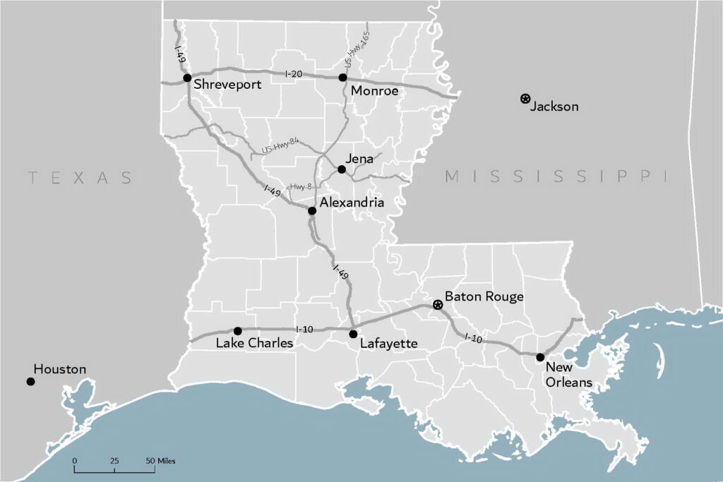
The first map shows where Jena is, in relation to larger cities and Interstate Highways. Jena is a small town (population about 3,300) that is the largest incorporated place in rural LaSalle Parish, Louisiana (population 15,000). Only two-lane roads serve Jena, which is in a hilly wooded area where timber is a major industry. It is 40 miles from the nearest Interstate highway and nearest city, Alexandria. Traffic was backed up for miles when tens of thousands of people tried to get into Jena for the big protest on September 20, 2007.
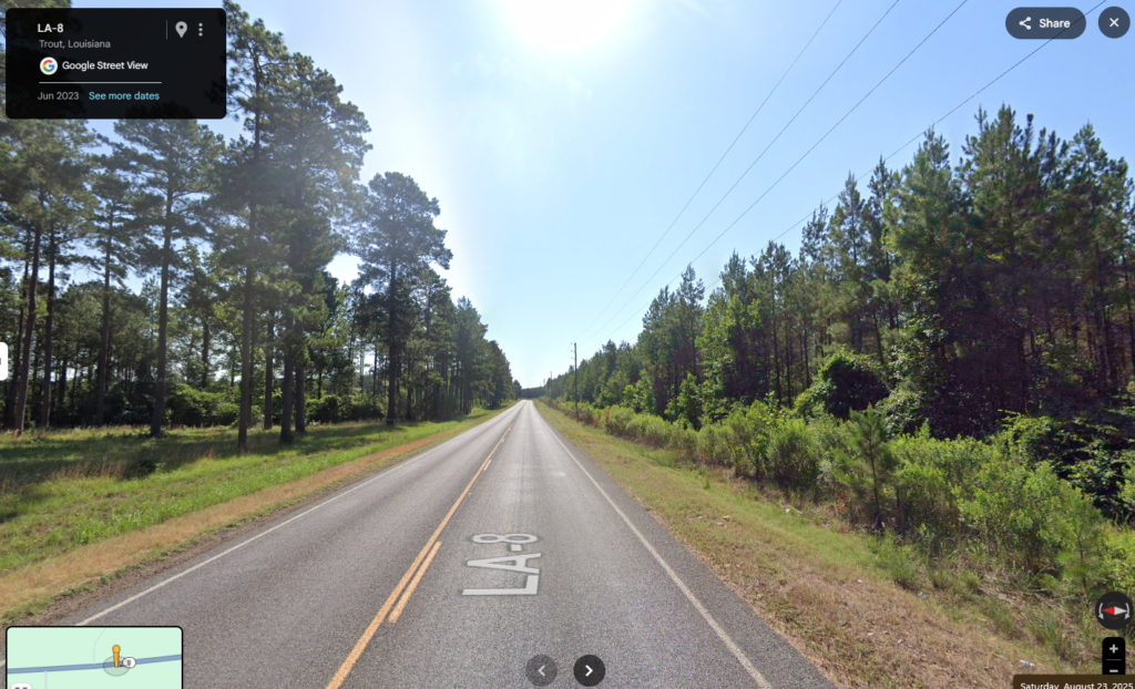
Here is a Google maps street view of Highway 8 near Jena.
The combined population of Alexandria and its twin city Pineville across the Red River was about 63,000 in 2007. The next nearest city, Monroe, population 50,000 is 65 miles away in the opposite direction. The Jena protest was staged out of Alexandria, which officially welcomed the protesters. Alexandria’s population is over half Black. It did not elect a Black mayor until 2018. However, even though it is majority White, Pineville elected its first Black mayor in 2000; he served for more than twenty years. Alexandria’s newspaper, radio station, and television station serve the Central Louisiana area and covered the Jena case.
Many of the people who came to the big Jena protest were from cities in Louisiana and Texas. In addition to Houston, the Dallas/Fort Worth metro area is just off the map to the west along I-20.
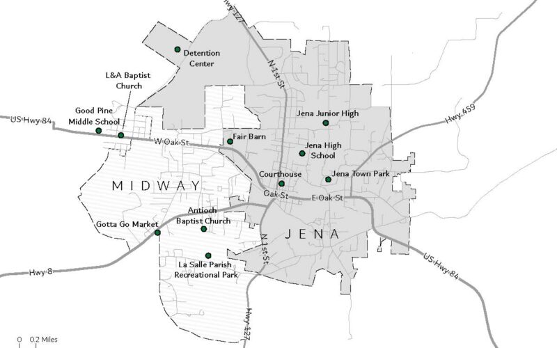
The second map shows Jena. News stories often mentioned that the Jena 6 and most Black Jena residents lived outside the town limits in an unincorporated area referred to as “Ward 10.” The Census Bureau has defined a Census designated unincorporated place named “Midway” that overlaps substantially (but not entirely) with Ward 10 of LaSalle Parish. The only Black member of the LaSalle Parish school board represented Ward 10 and lived within Midway’s boundaries.
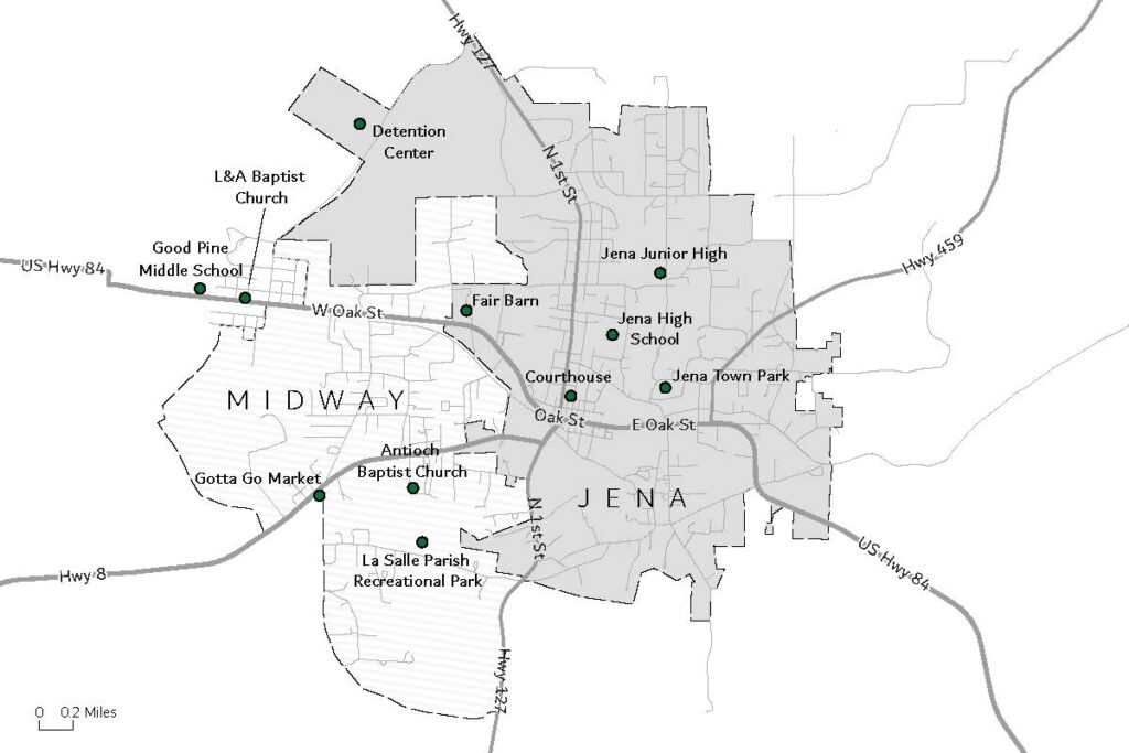
In 2010, over half (57%) of the Black residents of LaSalle Parish lived in the combined Jena-Midway area versus only 26% of the White LaSalle residents. The town limits of Jena are drawn so that in 2010 it was 84% White and 11% Black. In 2010, Midway’s population of 1,297 was 42% White, 50% Black, and 7% American Indian. The Jena band of the Choctaw has offices in Trout, about four miles west of Jena on US highway 84. Of the combined population of Jena plus Midway, 93% of the American Indian people and 65% of the Black people lived in Midway versus only 16.5% of the White people.
I have not been to Jena. It is interesting to use Google maps street view to look at different parts of Jena to see the places referred to in the news stories, and also to get at least some sense of what the neighborhoods in different parts of Jena looked like. I also learned that it is possible to look for older street view pictures for places that are now closed. Below are some screenshots of places that figure in the protest events.
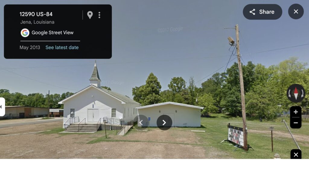
The original protest meeting about the nooses was at the L&A Baptist Church on Highway 84 in the unincorporated area (just outside the boundaries of Midway).
L&A Baptist Church, site of protest meeting about the nooses in September 2006.
The meetings of the LaSalle Parish NAACP and the Jena Six Support Committee were held at the Antioch Baptist Church, on a country street in Midway.
Antioch Baptist Church, where most of the Jena 6 and NAACP meetings were held in 2007

Gotta Go Market, where one of the fights occurred. (This market is now closed and has been replaced by a newer market neraby)

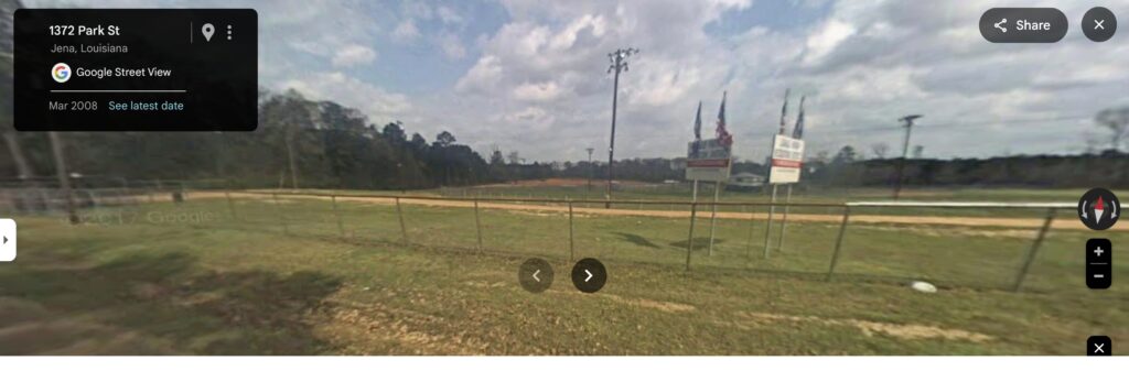
The LaSalle Parish Recreational Park is referred to as the “Ward 10 Park” in news stories about Jena. It was the place originally planned as the staging area for the September 20 march. This is a Google street view from 2008.